Explore Big Cypress

Play it safe, plan ahead, and be prepared, the Preserve is remote. In many areas cell phones do not work. There is no gas or food service in the Preserve. Services are found in nearby areas, including our gateway community of Everglades City. Wildlife lives in the Preserve; we are the visitors. For your welfare and theirs, enjoy animals at a distance. Do not feed or harm them. You are responsible for knowing firearm regulations: Visit our website or ask a park ranger for details.

Book Now

Explore the Preserve

Plan on spending at least a few hours in the national preserve, exploring scenic drives, roadside parks, and several of the viewpoints and boardwalks. If time permits, consider attending a ranger-led activity. Guided walks, short talks and campfire programs are offered daily, November through April.

Entering the backcountry requires that you fill out a backcountry permit. Be aware that there are several private properties in this area —respect private property and do not trespass. Travel to the north into the Big Cypress Seminole Reservation, or to the south into the Miccosukee Reservation— by foot, bicycle, vehicle or watercraft – is by tribal permit only.

Wildlife fencing is installed along I-75 to minimize the threat of wildlife, including the endangered Florida panther, from getting on to the busy roadway. If the automatic fence at the entrance of the parking area is not operational contact – 800-788-0511.

Scenic Drives

There are two popular scenic drives within Big Cypress National Preserve.

Loop Road Scenic Drive

One of the two popular scenic drives within Big Cypress National Preserve, it is a 27-mile drive that travels through dwarf cypress forest, pine forests and deep strands. Drive this scenic road, and explore some of the more remote areas of the Preserve. Loop Road, otherwise known as County Road 94, was created out of a dispute over the official route of the Tamiami Trail. The road is gravel for most of the route. We recommend asking a ranger about the current road conditions before travel. Loop Road is 24 miles long and is south of the current path of Tamiami Trail. It spans three counties: Collier to the west, Monroe in the center, and Miami Dade to the east. Visitors will pass through mostly cypress swamp, which are flooded forests in the summer wet season (May through October), but mostly dry in the winter, except for the areas of lowest elevation – the cypress strands.

Turner River, Wagonwheel, Birdon Roads Loop Scenic Drive

A 17-mile drive that takes you by open prairies and popular wading bird feeding areas. While visiting the national preserve, take the time to leave the beaten trail of US-41 (Tamiami Trail) and take a more leisurely journey along one of these scenic drives.
Shining waters, flurries of wings, and sunning alligators are all things you may experience along the Turner River Road in Big Cypress National Preserve. The 1950s brought the addition of this road to the Big Cypress Swamp. Building in South Florida presents a challenge for you must rise above the water by borrowing land. This creates a system of canals that mirrors the road ways. During the wet season, May to October, water is plentiful throughout the Preserve, and wildlife dispersed. The remainder of the year when water may be scarce canals provide habitat for a myriad of wildlife. As you travel, this guide will introduce you to some of the residents you may meet along the road.

Roadside Parks

HP Williams Roadside Park

This small roadside rest area is named for Homer P. Williams, an engineer, who worked for Barron Collier during the construction of Tamiami Trail in the 1920s.
Designated in 1965, by the Florida Legislature, this park is believed to be the first of its kind in the state of Florida.
There is a short boardwalk overlooking a canal where a variety of wildlife, including alligators, turtles, and a variety of birds are often seen. Picnic tables, and a vault toilet are available. Park rangers provide informative talks of various subjects here during the winter months.

Kirby Storter Roadside Park

Approximately halfway through your drive across Big Cypress along Highway 41 is Kirby Storter Roadside Park. Named after one of the area’s pioneering families, Kirby Storter worked for several years as a carpenter and electrician for Barron Collier, and later oversaw construction of South Florida roads (including Tamiami Trail) for the Florida Roads Department.
The Florida Legislature designated this park in Kirby Storter’s honor in 1971, just six years after his retirement. The popular Kirby Storter Boardwalk is also located here. This one-mile, round-trip stroll offers an excellent opportunity to explore a mature cypress strand without getting your feet wet. The boardwalk ends at an overlook, where you will often find a variety of wildlife enjoying the oasis.

Mile Markers

I-75 Mile Marker 51

The site is accessible to westbound travelers on I-75. Those traveling east may make a u-turn at Exit 49 (Snake Road) to gain access to the facility. Upon leaving the facility and continuing west travelers may make a u-turn at Mile Marker 63 to travel east.
The facility provides parking and access into the Northeast Addition Lands of the Preserve. Visitors may choose to park and hike directly into the backcountry from the parking facility. You may also drive along the levee road — on those portions open to street-legal vehicles — and park along the road to hike into the backcountry or fish in the L-28i canal.
If parking on the Levee Road park in a manner that does not block other traffic. The speed limit is 25 mph, no trailers are allowed along the levee road except by special permit.
At this time hunting and recreational off-road vehicle use are not allowed in this portion of the Preserve. Click the following links to learn where these recreational activities are currently allowed – Hunting, ORV Use.
There are no marked hiking trails into the area. Travel requires individuals be familiar with orienteering by map and compass or by the use of a GPS – be prepared.
You can fish in the L-28i canal or launch a vessel from the boat ramp. Fishing requires appropriate state licenses. Be sure to familiarize yourself with state regulations related to fishing and boating activities.
Dispersed camping is allowed and biking is allowed along the levee road.

I-75 Mile Marker 63

On Friday morning, August 22, 2014, the Florida Department of Transportation (FDOT) opened the Mile Marker 63 rest area, along Alligator Alley. Crews completed the $8.8 million project on schedule.
Work began in spring 2013 to replace the former rest area with a larger restroom facility, an upgrade of the wastewater and water treatment plant, improvements to two recreational access areas adjacent to the Big Cypress National Preserve nature trails, and construction of a new public safety center. The design/build project increases the number of restroom facilities from 30 to 44 including the addition of four family restrooms. Each recreational area will accommodate up to 15 vehicles and 25 trucks or trailers. Improvements also include various site improvements such as lighting, landscaping, and resurfacing.
The new public safety center will accommodate four to six Collier County EMS personnel and will assist in reducing response times to incidents along Alligator Alley. With FDOT’s funding in place for Collier County’s operation of the public safety center, county staff has begun preparations to occupy the new facility. It is expected to be operational in late 2014. The facility provides parking and access into the Northeast Addition Lands of the Preserve. Visitors may park and hike directly into the backcountry from the parking facility.
At this time hunting and recreational off-road vehicle use are not allowed in this portion of the Preserve. Click the following links to learn where these recreational activities are currently allowed – Hunting,ORV Use.
The Florida National Scenic Trail, along with a few associated trails, may be accessed from this area. Visitors may also hike off trail, but this requires individuals be familiar with orienteering by map and compass or by the use of a GPS – be prepared.
Dispersed camping is allowed.

I-75 Mile Marker 70 Westbound

There are no restrooms or potable water available. This facility is accessible from I-75 westbound only. This facility has a walk-through gate in the wildlife fence* that allows access into the Bear Island Unit of the Preserve.
Hiking, walk-in hunting, fishing and camping in designated areas (Bear Island, Pink Jeep, and Gator Head Campgrounds) is allowed from this site.
There are no marked hiking trails originating from this site. Travel requires individuals be familiar with orienteering by map and compass, or by the use of a GPS unit, be prepared.
Upon leaving the facility, continuing to the west, a u-turn can be made at Mile Marker 80 to return eastbound.

I-75 Mile Marker 70 Eastbound

There are no restrooms or potable water available. This facility is accessible from I-75 eastbound.
This facility has a walk-through gate in the wildlife fence* that allow access into the Turner River Unit of the Preserve.
Upon walking into the area you will be on designated off-road vehicle trail TRU-2 (Cypress Lane). You can follow the trail to a network of other designated trails that allow for off-road vehicle use (must use other access points), hiking and biking.
Hiking, biking, walk-in hunting, fishing and dispersed camping is allowed from this site. Biking is allowed only on designated off-road vehicle trails, and not all designated
trails will be suitable for biking. You may hike on designated trails or choose to orienteer with map and compass or GPS cross-country, be prepared.
Upon leaving the facility, continuing east, a u-turn can be made at Mile Marker 63 to return westbound.

Ranger-Led Activities

Join the Big Cypress National Preserve staff for free outings and activities that explore the wonders of the Big Cypress Swamp. For more details, visit our website at www.nps.gov/bicy. Some programs require reservations, which can be made up to 14 days in advance, between 9:00 a.m. and 4:00 p.m. daily. Programs extend through April 14, 2018.

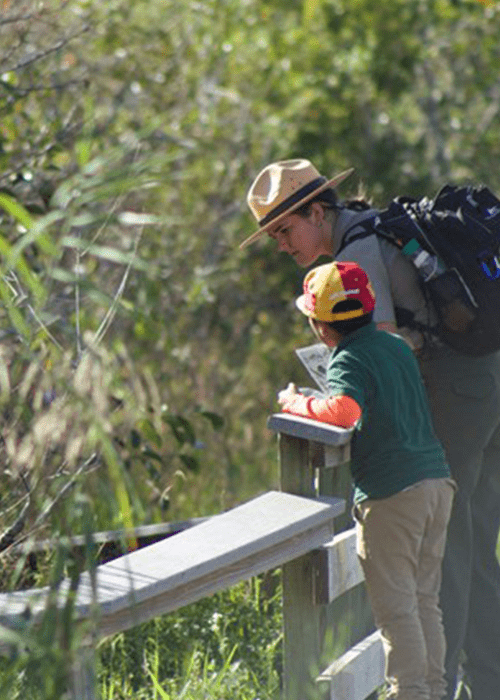
Before your adventure begins always let someone know where you are going and when you plan to return. Remember to fill out a backcountry permit if you are entering at one of the backcountry access points. To enjoy your visit come prepared by bringing water, food, sturdy shoes, sun protection, and insect repellent. Always be aware of your surroundings and be respectful of wildlife.

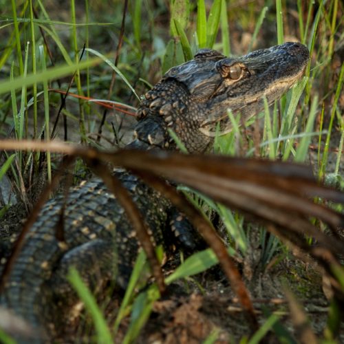
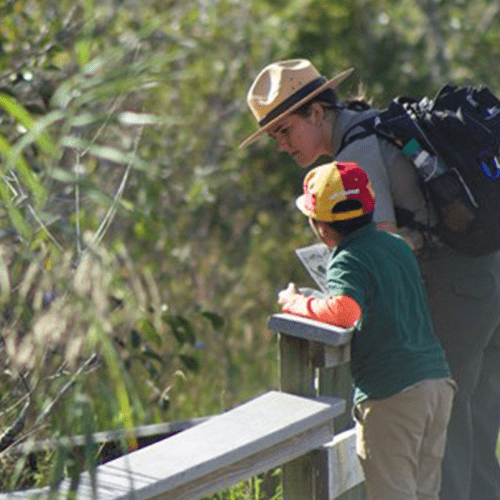
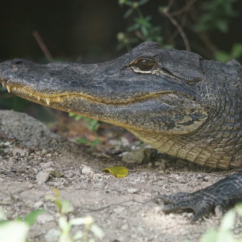
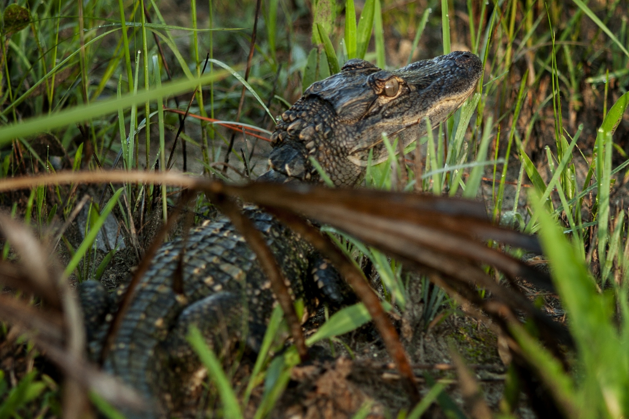
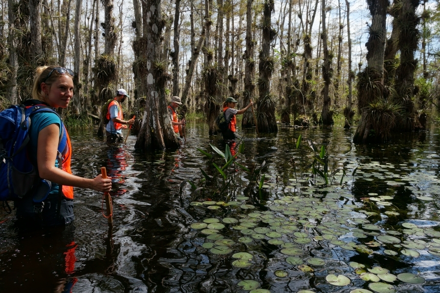
Wildlife Viewing: While visiting you may see a multitude of bird life, alligators and fish. Observe wildlife respectfully. Never attempt to feed or approach wild animals. Wildlife observation platforms are located at the Big Cypress Swamp Welcome Center, H.P. Williams Roadside Park, Kirby Storter Roadside Park, and at Oasis Visitor Center.

Driving: There is excellent wildlife viewing by car along the Turner River/Birdon Road loop, starting at H.P. Williams – 17 miles in length. Loop Road, another great option – 24 miles in length. These gravel roads offer views of national preserve animal life and subtropical habitats. Plan ahead and travel with a full tank of gas. Help protect wildlife by observing the speed limit. Stop by Big Cypress Swamp Welcome Center or Oasis Visitor Center for more information.

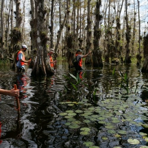
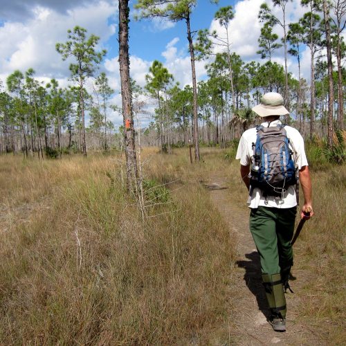
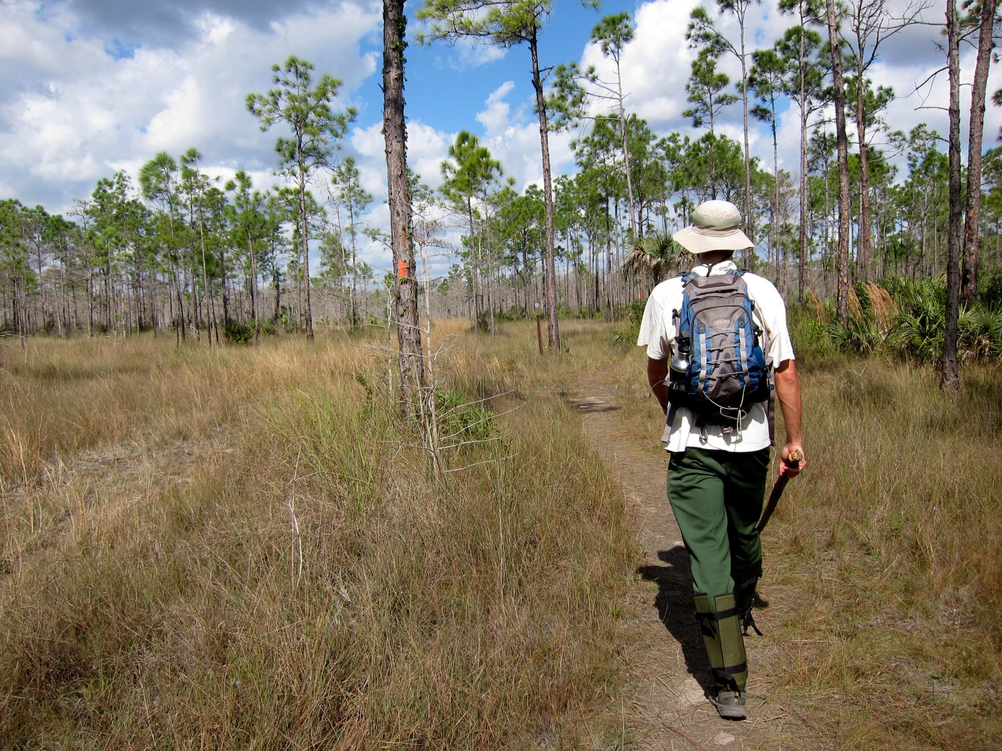
Hiking: The Florida National Scenic Trail runs through the heart of Big Cypress, presenting excellent backpacking opportunities in wetland habitats. Fire Prairie Trail is five miles round trip and is found off of the northern end of Turner River Road, providing superb views of several of South Florida’s natural habitats.

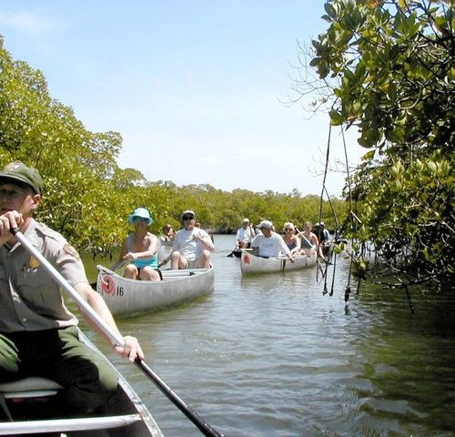
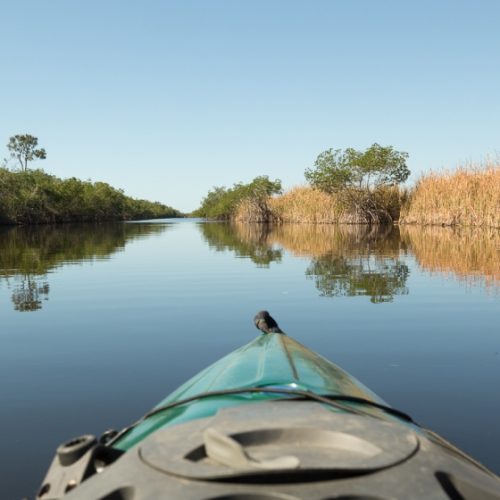
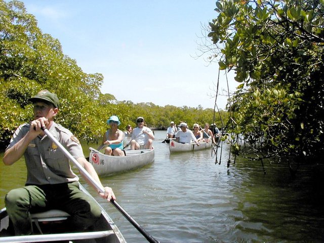
Canoeing: Explore the waters of Big Cypress by bringing your own canoe or kayak, or renting them in nearby communities. The access for Turner River Canoe Trail is located along U.S. 41. Halfway Creek Canoe Trail offers a saltwater option with the ramp located off of U.S. 41 at the end of Seagrape Drive, three miles east of S.R. 29. Typical canoeing trips in the area will take a minimum of two to three hours.

Biking: Within the preserve, many of the gravel roads off of Tamiami Trail, and several of the off-road vehicle trails, provide opportunities for exploration by bicycle. The Bear Island Grade, accessible from S.R. 29, is a popular route. While biking, please be aware of traffic. While on backcountry trails yield to hikers and off-road vehicles. For more details on bike riding in the national preserve, please ask a park ranger or www.nps.gov/bicy

Support the Big Cypress National Preserve

Make a donation, contribute with purchases, or offer your time and experience.

Get Involved